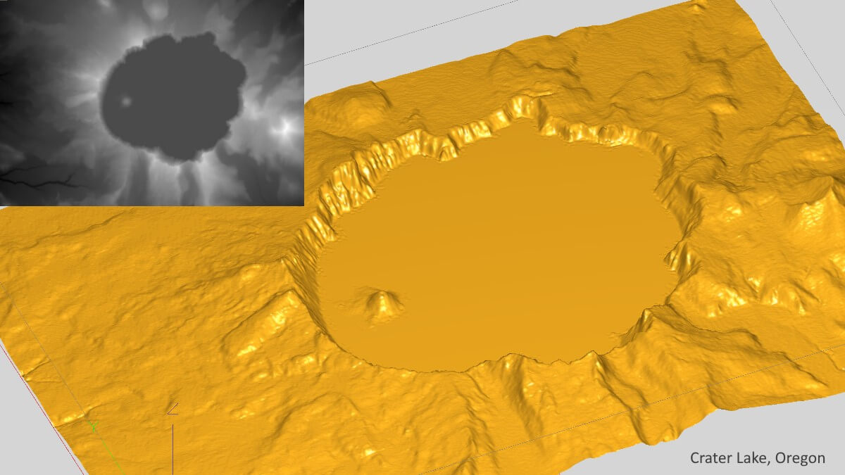
A height or height map is a special kind of image that looks like a black and white picture. They are specially designed so that lighter areas represent higher parts of the model, and darker areas represent lower parts. Using the darkness of each pixel, the software can recreate a 3D scene.
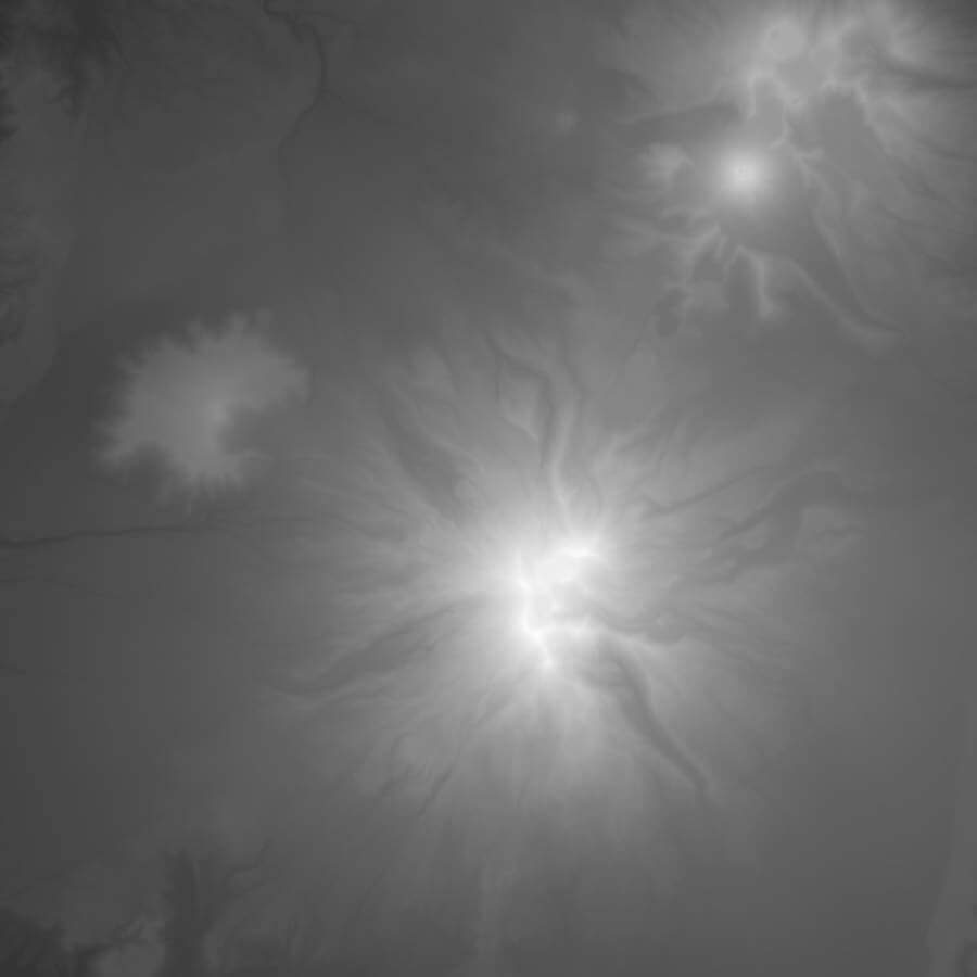
A depth map representing a mountainous region.
Terrain Example
This height map was created from terrain data and shows a region with two mountains - the lightest areas. The result is a 3D representation of the region that can be machined.
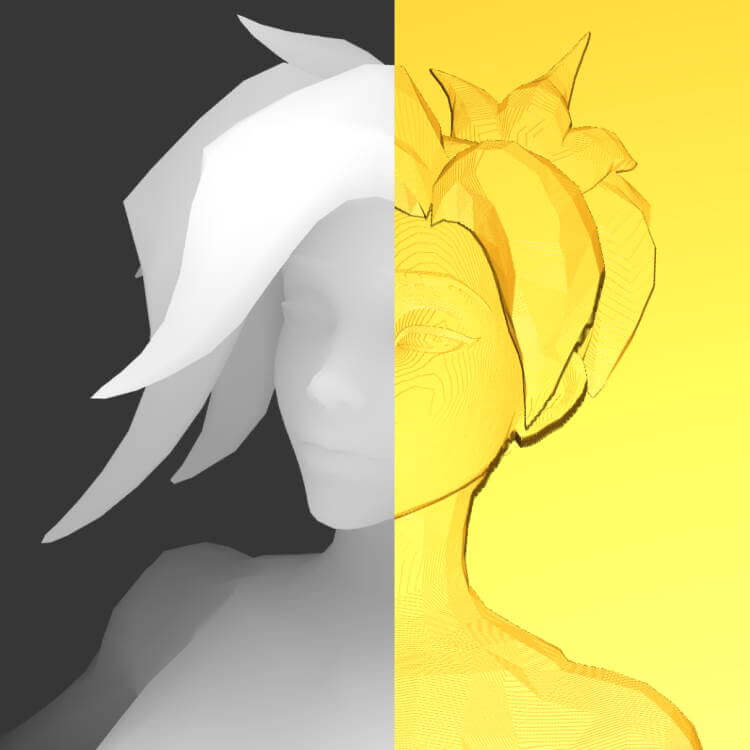
A depth map on the left and its associated geometry on the right.
Character Example
The depth map on the left was used to create the geometry shown on the right. The image depth in the stock material is chosen during import.
Finding Depth Maps
Depths maps are typically created by artists specially skilled in their creation. You can find various online repositories of free and paid depth map downloads. They are kind of like 3D clip art. Some depth maps may work better than others, depending on how they were created.